Section A northwards

Irvine to Saltcoats

Waypoints: WP1 Harbour Arts Centre, WP2 167 High Street, WP3 Burns statue, WP4 Bartonholm ('Garnock'), WP5 Saltcoats harbour
Distance: 13 km, 8.1 m.; Time: ... hrs;
Terrain: footpaths and cycle routes
Access: Ardrossan-Kilmarnock and other buses at Irvine High St; Glasgow-Ayr trains at Irvine station
Download pdf of this section
>> next section (B northwards)

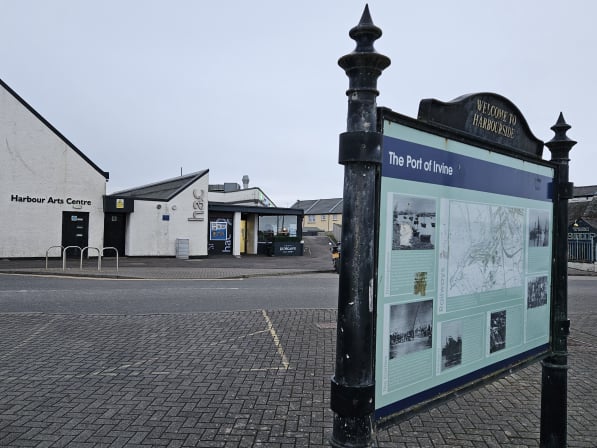
HAC photo I J Dickson

Waypoint 1 : Harbour Arts Centre
(see website for events and exhibitions) 
What3Words ///even.sober.flips
Cafe, art gallery and toilets - built as a Mission Hall in 1888 - see HAC history on the web.

We start at the harbour - busy in Galt's time - in 1819, it exported over 25,000 tons of coal and imported over 6,000 tons of grain - Irvine itself had 87 vessels and 517 seamen. John Galt's father was the captain of a West Indiaman sailing between Greenock and Jamaica, and the young John was taken to Greenock "every year" until the family moved there when he was aged ten. When Galt was born, the Ship Inn was owned by Provost Charles Hamilton, whose son John was a firm friend of Robert Burns. For more about Irvine harbour visit www.irvineharbourside.org

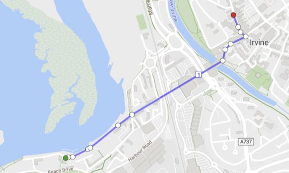
HAC to High St
map (c) OpenStreetMap contributors;
on phone, turn sideways


Enjoy the sea air from the Arts Centre up Harbour Street - enjoy the vessels of the Scottish Maritime Museum (see website). Now or another time, visit the Linthouse Building (many fascinating exhibits) and the 1920's shipyard worker's flat. At the Puffers Cafe, you join Montgomery St, named after James Montgomery (see info panel).
Along the route are blue plaques commemorating harbour people – including, at the HAC, Sir Andrew Duncan, son of the harbour missionary George Duncan, the first missionary in the Mission Hall which is now the Harbour Arts Centre theatre; at the Ship Inn, Captain Richard Brown, who prompted Robert Burns to publish his poems; at the Water Sports Club, David Gilkison, the Irvine shipbuilder and a relation of John Galt; and, at the Scottish Maritime Museum, David Sinclair, for 32 years coxswain of the Irvine lifeboat.
At the railway bridge, walkers should ignore the NCP7 sign, and go straight ahead into the Bridgegate Shopping Centre (cyclists and motorists take a different bridge under the railway).
Walk through the shopping mall, enjoying the river view. In Galt's day, a 1753 stone bridge crossed here (the 1889 iron bridge was demolished in 1973).
You emerge onto the pedestrian area overlooked by Trinity Church - its three 1869 bells are on display, one at the foot of the path, one at the top, and one on the far side of Irvine Cross. Walk to the road junction (Irvine Cross). At one of the town inns here, the Pringle family boarded the stagecoach (from Ayr) which would take them to Greenock.
Turn left onto the High Street, making for no. 167, the Bank of Scotland, on the site of Galt's birthplace.

There are many refreshment options along the harbourside, including Gro cafe, the Ship Inn, Duncan's restaurant in the Arts Centre, Smalltalk coffee shop, the Harbour Lights public house, Puffers cafe at the Scottish Maritime Museum, the Niche restaurant and the award-winning Vanilla Joe's ice-cream shop. In Rivergate Mall there are Wetherspoon's The Auld Brig public house, Gregg's cafe and Freckleton's cafe.
Toilets are in the start Waypoint at the Arts Centre, and of course in the refreshment options, and in the Portal at the Town House near Irvine Cross.

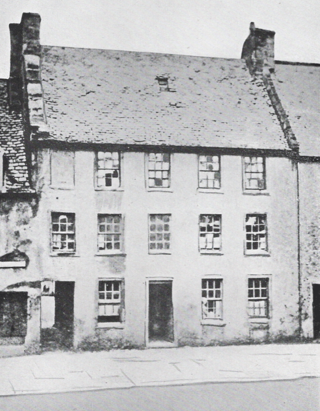
Galt's birthplacephoto I J Dickson

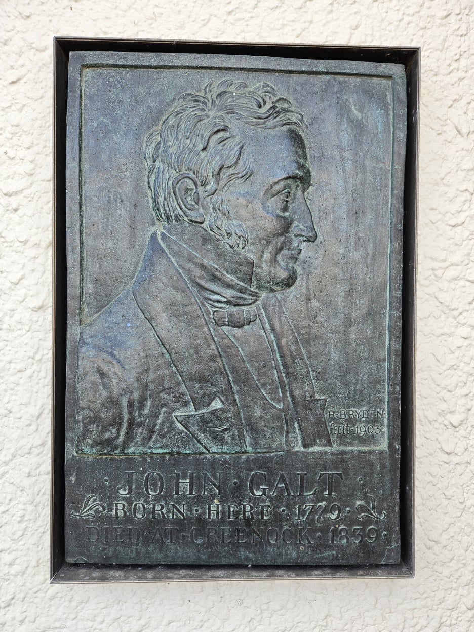
Waypoint 2: Galt's birthplace, now 167 High Street (at the Bank of Scotland)
What3Words ///dips.pill.comical

This bronze plaque (by Ayrshire artist Robert Bryden, R.A., in 1903) marks the site of the house where John Galt was born on 2nd May 1779. His family moved to Greenock in 1789. Heritage highlight: View a photo of the house! Irvine Burns Club lay a wreath here each year on the anniversary of Galt’s birth.
The Wellwood Burns Centre and Museum is only two minutes’ walk to the north, on the opposite side, at 28 Eglinton Street, the red sandstone building with two Provost’s lamps. Book your free museum visits via the website www.irvineburnsclub.org.

quotation John Galt wrote: "I was a soft, ailing, and growing boy. I have no remembrance of the enjoyment of perfect health for many years, and yet I was not ill. . . When not engaged with my flowers [in the garden], I lounged on my bed, which gave me a kind of literary predilection: all sorts of ballads and story-books were accumulated by me, and some of them have left impressions that still remain fresh and unfaded." ("Autobiography", 1833, p.9)

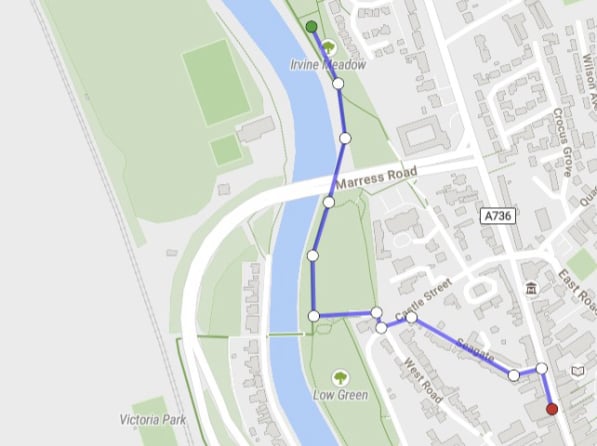
High St to statue
map (c) OpenStreetMap contributors

Walk a short distance north to take the cobbled road on the left, Seagate, so called because it leads to where, in early medieval times, sea-going ships would beach or tie up on the river.
Seagate Castle, on your right, is a mid-16th c. town house of the Earl of Eglinton. A misleading wall plaque claims that Mary, Queen of Scots, visited the castle on 1 August 1563, but records are clear that she stayed at Eglinton Castle.
At the foot of Seagate, cross Castle Street, pass the ‘West Road Centre’ (the former fire station), and take the lower path along the river - or the upper path with two seats to enjoy the scene, but steps afterwards.
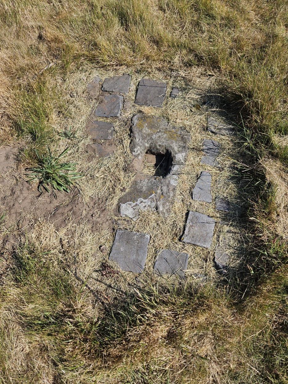
At the river, you are rejoining the Ayr Coastal Path (also cycle route "(73) [7]" and the New Town Trail), to pass under the road bridge, and onwards to meet a path coming from a footbridge - near here is an interesting stone - Read about it here . . . .
Follow the path to the statue of Robert Burns.

The High Street is served by many bus routes, the main one being the Ardrossan-Kilmarnock no. 11 (mostly double-deckers) at 15 minute intervals or oftener. Car parking is available behind the High Street, on East Road, with closes (alleys) giving easy access.

Burns statuephoto I J Dickson

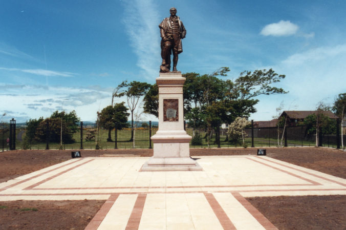
Waypoint 3: Robert Burns statue
What3Words ///rungs.offers.behind
(A path through the houses connects with the main road at the Police Station.)

This 1896 statue is highly regarded, as a fine one of the poet, who is facing south towards his birthplace of Alloway. After admiring the statue - Heritage Highlight: more about the statue - continue to follow the River Irvine towards the railway and on to Bartonholm recycling centre, following the NCW7 cycle path.

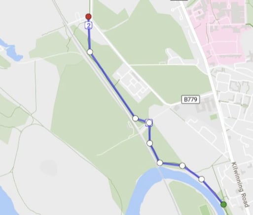
Statue to Bartonholm
map (c) OpenStreetMap contributors

Continue past the weir and follow the bend of the river to the railway, which you then keep to your left. On your right is the Cadgers’ Racecourse, named from the races held by the itinerant carriers or carters; it hosts the Irvine Carters Society races at the Marymass Fair each August. The tall pole is the Greasy Pole, which teams of young men attempt to scale each August as they try to carry off the ham wired at the top.
Cross the Bogside Golf Club access road (deviate a few steps to the railway bridge for a view over the Golf Course; beyond it was Bogside Racecourse, the venue for the Scottish Grand National until 1965, the oval shape on the map).
Stay on the east side of the railway – keep on the NCW7 cycle path.
Pass the recycling centre entrance and continue on the path north.

The no.11 bus (Kilmarnock - Ardrossan) has a stop near the Police Station. See the next Waypoint for details of access and parking at Bartonholm.

Bartonholmphoto I J Dickson

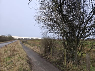
Waypoint 4: Bartonholm (pause halfway between the recycling centre and the bridge over the R. Garnock)
What3Words ///verve.famed.vast

You are very near the fictional “rural village of Garnock . . . pleasantly situated between Irvine and Kilwinning”, the home of the Pringle family in ‘The Ayrshire Legatees’, where Dr Pringle, the incumbent minister, is “much loved by his parishioners”. Galt's 'Garnock' was very possibly Bartonholm, a coal-mining hamlet, which no longer exists; it lay a short distance west (on the other side of the 1839 railway) where Irvine Golf Club hole 15 is today. In later years, that 350-person hamlet produced three Scottish amateur golf champions (Hamilton ‘Hammy’ McInally, Jimmy Walker and Jack Cannon). Half a mile further west, at today's Irvine Golf Club hole 13, was another long-gone mining hamlet, Snodgrass – perhaps this is why Galt named the other local minister as Dr Snodgrass.
The Pringle family in the novel went first to Irvine to take “the coach to Greenock”.

quotation The reason for the Pringle family journey: On New Year's Day Doctor Pringle received a letter from India informing him that his cousin had died at Hyderabad and left him his residuary legatee. The same post brought other letters from the agent of the deceased in London. . . . It was determined that, as soon as arrangements could be made, the doctor and Mrs Pringle should set out for the metropolis; and, as Rachel had now a "prospect before her", that she should accompany them. . . . The doctor had been for many years the incumbent of Garnock, which is pleasantly situated between Irvine and Kilwinning . . . and was much loved by his parishioners.  ('The Ayrshire Legatees', Chapter 1)

. . . and, on their return:

"a shout announced that a carriage was in sight. It was answered by a murmuring response of satisfaction from the whole village. In the course of a few minutes the carriage reached the turnpike: it was of the darkest green and the gravest fashion; a large trunk, covered with Russian matting . . occupied the front . . the blithe faces of the doctor and Mrs Pringle were [seen]. The boys huzzaed, the doctor flung them penny-pieces, and the mistress bawbees . . the old men reverently took off their hats and bonnets . . all the village dogs came baying and barking forth . . "  ('The Ayrshire Legatees', Chapter 10)

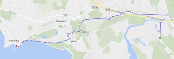
Bartonholm to Saltcoats
map (c) OpenStreetMap contributors;
on phone, turn sideways


Continue to the bridge over the R Garnock. On the left is the Scottish Wildlife Trust’s Garnock Floods Nature Reserve, an important wetland sanctuary for duck, geese and waders. (There are no internal paths on the reserve to minimise disturbance to bird life. You can view the reserve from the hide, cycle-path or the grass path beside the river. For the hide, enter the field over the stile by the gate and approach the hide from the back to avoid spooking the birds you hope to observe. Dog walking is discouraged.) From the bridge there are good views of the Ardeer dunes, described on Armstrong’s map as the Ardeer Hills. There, in 1870, Nobel established his explosives, and later chemical, works; in WWII the works employed 13,000 people; in the 1980s and ‘90s, the redundancies were disastrous for the local economy. Looking over that area now, you need to imagine a huge industrial complex with tall chimneys and a massive cooling tower - which collapsed overnight in a 1972 storm.
At the north side of the bridge, cross the road to the New Town Trail - also cycle route (73) 7 and a Core Path. The Way passes under the A78 and winds upriver along a wooded bank into Kilwinning, a town known for the Eglinton estate to the east and the ruins of its ancient Abbey in the centre.
Where a cycle route comes in from a bridge on your right, turn left and keep straight on, unless you wish to detour into Kilwinning. Follow the cycle way through an industrial estate to join Byrehill Road, passing under the railway to Ayr, then the A78 at Todhill Farm, then the railway to Ardrossan.
Pass the caravan park and Ardeer Mains farm on to the B732. Cross this road to enter Ardeer Park, passing the miniature golf course and along an old earthwork dam.
After passing an ornamental loch, join New Street in Stevenston. Turn left towards the railway.
After the level crossing, either continue on the NCN73 (on our map) or walk down Shore Road to the west end of Stevenston Beach Park to follow the coastal path westwards. The strange grey shoreline rock on the Beach Park promontory to the east is iron slag, the remains of the slag bing of a 19th c. iron works built near Ardeer coal pits.
Follow the path along the sea wall to the harbour, taking care if it is stormy.
Bartonholm is on a side road, the A779, which leads from Kilwinning Road to the River Garnock - no through road north to the bypass, though access is possible southwards from the bypass to Bartonholm. Therefore, it is easily reached by car either from Irvine or from the bypass, and there is enough opportunity for parking on the roadside. Saltcoats harbour is on the access road beside Aldi and Iceland superstores.

Saltcoatsphoto I J Dickson

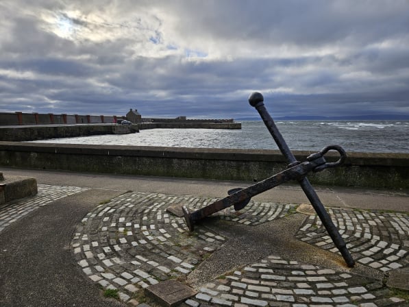
Waypoint 5: Saltcoats harbour
What3Words: ///wharfs.quicksand.just
(next to Aldi and Iceland stores)
Saltcoats, once a small fishing village, gets its name from the cottages of folk who evaporated salt from seawater for the curing of fish - "salt-cots". When coal was found, the harbour was built in 1684 for its export; in 1772 a two-mile canal was dug to bring coal to the harbour. In 1812, on land reclaimed from the sea, a horse-drawn railway was built. The harbour could handle up to 24 vessels (of 20 to 200 tons) exporting coal, salt and textiles, and importing fish and grain. The seaward extension was added in 1847. Just north of the harbour are three sea-water bathing pools, no longer popular!