Waypoints: WP5 Saltcoats harbour, WP6 Ardrossan Marina, WP7 Seamill (Hydro)
Distance: X m, Y km; Time: Z hrs;
Terrain: surfaced, mostly cycle routes, no obstacles
Access: regular town to town services, including the Kilmarnock-Ardrossan no.11 regular service
Download pdf document of this section - in preparation
>> next section (C northwards)
photo I J Dickson
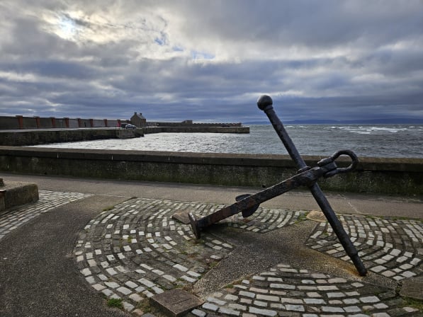
Waypoint 5: Saltcoats harbour
What3Words ///wharfs.quicksand.just
(next to Aldi and Iceland stores)
Saltcoats, once a small fishing village, gets its name from the cottages of folk who evaporated salt from seawater for the curing of fish - "salt-cots". When coal was found, the harbour was built in 1684 for its export; in 1772 a two-mile canal was dug to bring coal to the harbour. In 1812, on land reclaimed from the sea, a horse-drawn railway was built. The harbour could handle up to 24 vessels (of 20 to 200 tons) exporting coal, salt and textiles, and importing fish and grain. The seaward extension was added in 1847. Just north of the harbour are three sea-water bathing pools, no longer popular!
Follow the path round South Bay to Princes Street and cross the level crossing.
You may wish to detour via Bute Place on your right to make for Castle Hill (steps). Probably built in the 13th century, its history includes occupation by the English, recapture by Sir William Wallace, and removal of stones by Cromwell to build his Citadel at Ayr; you can return to Ardrossan Cross by a zig-zag path down the north-west slope.
to be added
photo I J Dickson
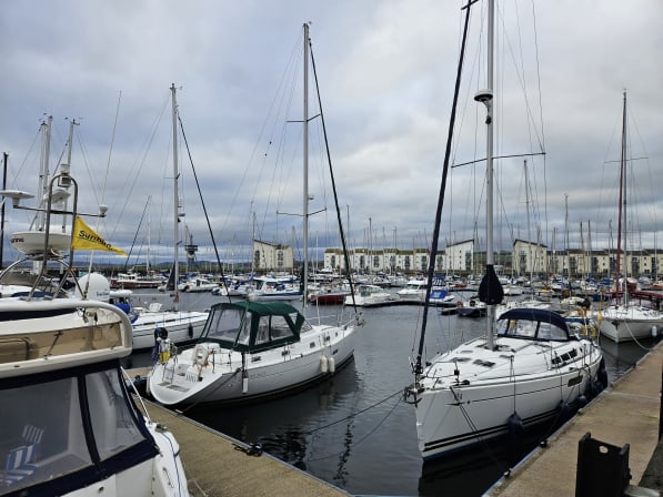
Waypoint 6: Ardrossan Marina
What3Words ///buns.cross.souk
Ardrossan harbour was begun in 1805 by the 12th Earl of Eglinton to enable his coal and limestone exports. In 1839 the large dock was constructed. Although usually the mainland terminus of the ferry to Brodick on Arran, this service is currently operating from Troon as the dock is not yet adapted for today's larger ferries.
In 'The Ayrshire Legatees', Miss Rachel Pringle writes to Miss Isabella Todd:
"The weather was cold, bleak, and boisterous, and the waves came rolling in majestic fury towards the shore when we arrived at the Tontine Inn of Ardrossan. What a monument has the late Earl of Eglinton left there of his public spirit! It should embalm his memory in the hearts of future ages, as I doubt not but in time Ardrossan will become a grand emporium; but the people of Saltcoats - a sordid race - complain that it will be their ruin, and the Paisley subscribers to his lordship's canal grow pale when they think of profit." (Chapter 1, letter 2)
Hugh Montgomerie (d. 1819), the 12th Earl of Eglinton, laid the foundation stone for Ardrossan Harbour in 1806 with the vision of creating a major port connected to Glasgow and Paisley by canal; only 11 miles of canal was built before funds ran out and investment ceased.
Galt's Tontine Hotel is undoubtedly the 18-bedroom Eglinton Arms Hotel, built in 1806-07 as a guest residence for the 12th Earl, described in 1820 as "unquestionably, the most superb of any [hotel], out of a great town, in Scotland", empty by the time of a fire in 2000, since demolished and replaced by new housing on Princes Street.
Make your way to the wide public promenade round the Marina, where once there was an oil terminal and a shipyard.
At the top of the bay, you can either follow the asphalt path alongside the A78 or wander along the shore until it proves necessary to join the roadside path for a short distance.
Offshore lies Horse Island, providing shelter to the bay and with, at its south end, a landmark beacon erected by the Earl of Eglinton in 1811; the island is now a seabird nature reserve.
Several car parks along the route offer picnic stops and useful rendezvous points (but height restriction bars often, sadly, rebuff motorhome travellers).
At the caravan park and pub, take the path out round South Inch point.
On passing The Waterside restaurant, you see the road which may have been the coach route into West Kilbride (Chapelton Road; B7047), but it is too narrow and busy for walkers, so the John Galt Way will take you on a much more attractive route into West Kilbride.
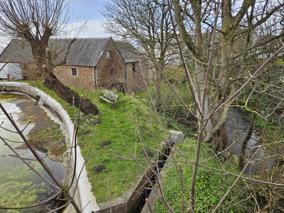
At the bus stop before Seamill Hydro, at the bridge over the Kilbride Burn, look over the wall to your left to the mill that gives Seamill its name - still with its millwheel. Heritage Highlight: the Seamill Mill.
You reach Seamill Hydro. The next stage starts at the small road opposite the entrance.
At Ardrossan Marina, you will be next to Cecchini's Restaurant & Bar. On your walk to Seamill, you will pass The Waterside restaurant, and then Seamill Hydro provides a restful halt. Later, in West Kilbride, the cafes include the Fable Coffee Bar on your route at Glen Road and, on the main road slightly uphill on the right, the Barony Cafe.
We recommend that, after leaving Ardrossan, cyclists stop at the first roadside parking area and cross to take the small road marked 'Glenfoot' - it offers a quiet and pleasant country route to West Kilbride (rather than the busy road from opposite the Waterside restaurant or our walking route through the Glen or the steep road at later traffic lights).
In 'The Ayrshire Legatees', Miss Rachel Pringle writes to Miss Isabella Todd:
"The road, after leaving Ardrossan, lies along the shore. The blast came dark from the waters, and the clouds lay piled in every form of grandeur on the lofty peaks of Arran. The view on the right hand is limited to the foot of a range of abrupt mean hills, and on the left it meets the sea: as we were obliged to keep the glasses up, our drive for several miles was objectless and dreary." (Chapter 1, letter 2)
photo I J Dickson
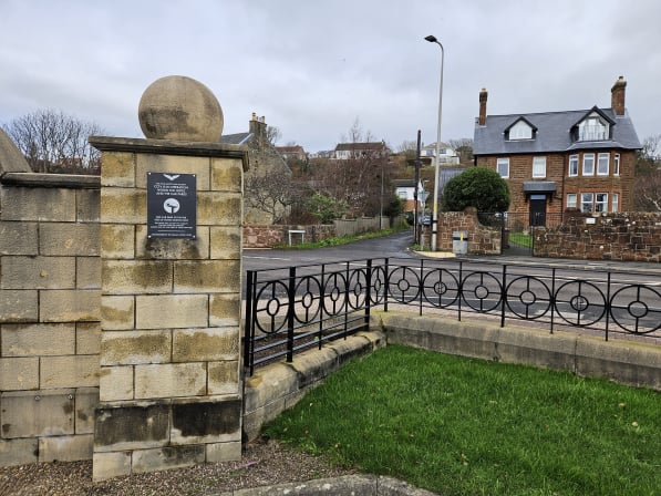
Waypoint 7 Seamill (Hydro entrance):
What3Words ///affair.middle.musically
Seamill Hydro opened in 1881 as the Seamill Sanatorium hydropathic spa, funded by ten businessmen each paying £600. Today it offers a wide range of health and refreshment opportunities. Opposite the entrance is Glenbryde Road, your route as you continue to stage C of the John Galt Way.